Notable events archive
November 1, 2026 — Newfoundland added
The map now has a Newfoundland region alongside Southern Ontario, with all 14 layers. Newfoundland has no archive reconstructions yet; the cases below are Southern Ontario.
Storm surge and seiche checks
The new storm surge model was run on past storms without tuning: Lake Erie December 23 2022 (Buffalo +2.37 m observed vs +2.51 m modelled; Toledo −2.88 m vs −2.22 m), Lake Erie October 31 2019 (Buffalo +1.90 vs +1.56 m; Toledo −1.60 vs −1.31 m), post-tropical Fiona September 24 2022 (Port aux Basques +0.88 vs +1.99 m, wave setup overdone; Argentia +0.58 vs +0.94 m) and Hurricane Larry September 11 2021 (St. John's, Argentia and Bonavista: surge mostly missed). Full table on the Methodology page.
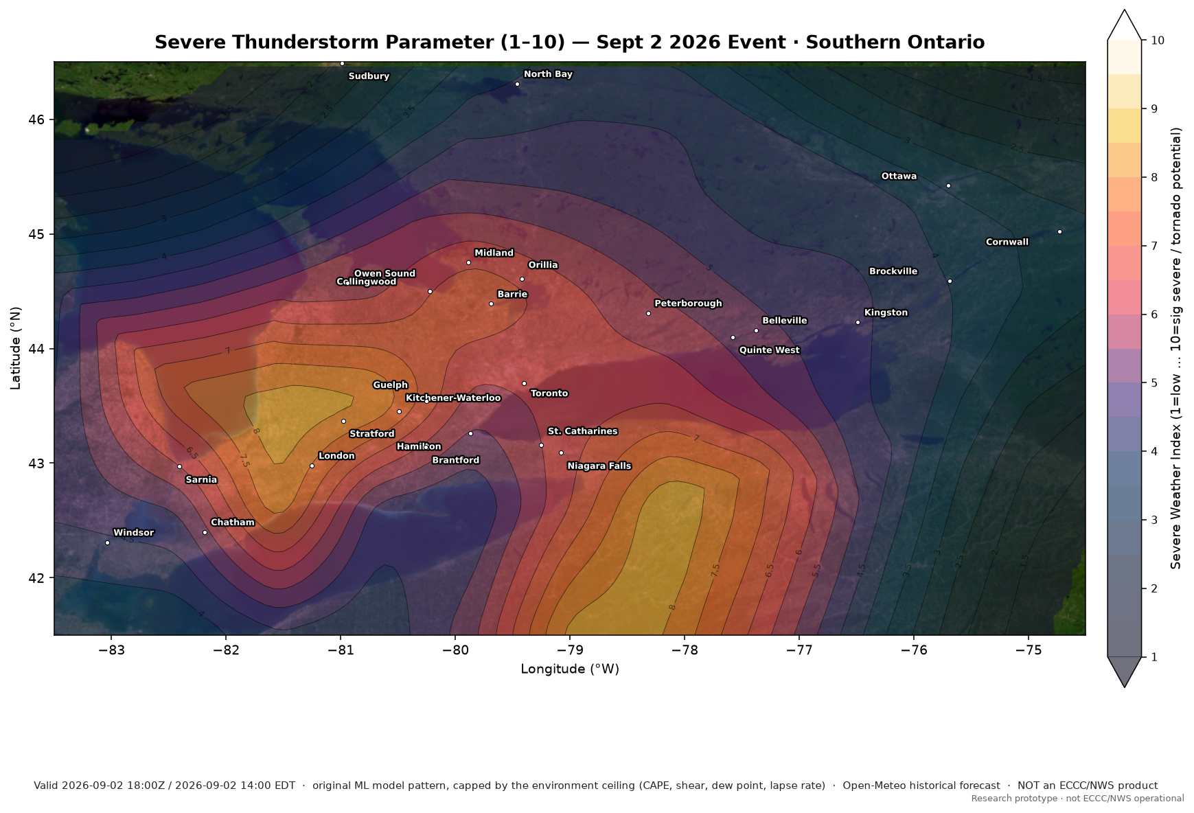
September 2, 2026 — southern Ontario severe environment
Severe Thunderstorm Parameter (1–10; original machine-learning model pattern, capped by the environment ceiling), valid 2026-09-02 18:00Z (2:00 PM EDT), forecast 6 hours ahead from the 12:00Z (8:00 AM EDT) frame. Original model peak 8.5, identical to the original Sept 2 render; with the environment ceiling applied (Nov 1 2026) the peak is 8.4. The Control Thunderstorm Volatility Index on archive fields peaked at 9.2.
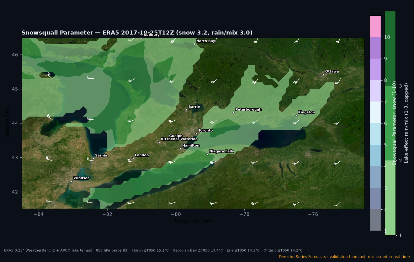
October 25, 2017 — autumn lake-effect rain/mix check
Snowsquall Parameter validation case: cold air over still-warm lakes (lake–850 hPa difference 13–15 °C) but a profile mostly too warm for snow. Green 1–3 = lake-effect rain/mixed precipitation (capped at 3); blank = none. Assumed rain case from climatology, not radar-verified.
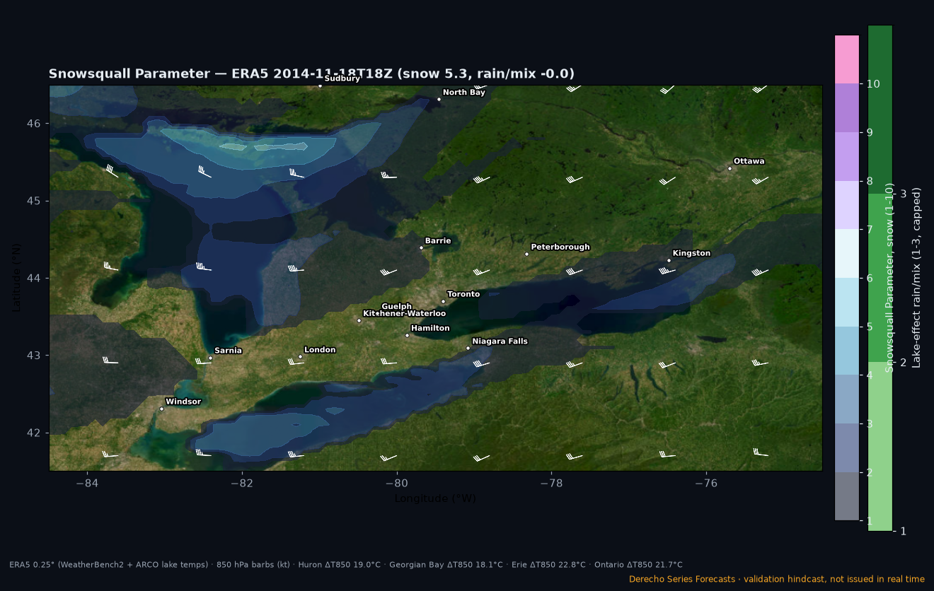
November 18, 2014 — “Snowvember” Lake Erie band
Snowsquall Parameter (1–10) recomputed from ERA5 reanalysis (0.25°, 18:00Z / 1:00 PM EST) with ERA5 lake mix-layer temperatures. Hindcast for validation only — not issued in real time. The map peaks at 5.7 in Lake Michigan- and Superior/North Channel-fed bands (across the Michigan Thumb toward Sarnia, and north of Georgian Bay). The famous Lake Erie band into Buffalo is under-represented (≈2–3) at ERA5’s 0.25° resolution — an honest miss in band intensity.
More events will be added as they happen.